Structures and Construction Monitoring (Structures Monitoring & Construction Monitoring) is a system for observing the process of building construction using aerospace imaging technologies, such as aerial imagery, unmanned aerial vehicles (UAVs), and laser scanning, at defined intervals.
Structures and Construction Monitoring (Structures Monitoring & Construction Monitoring) with remote sensing data is a system for collecting up-to-date and reliable information on the construction progress, allowing for analysis and assessment of the overall situation on the construction site.
Aerospace construction monitoring is carried out for:
- Making timely and informed engineering and managerial decisions;
- Obtaining information on the site's condition as close to real-time as possible, enabling analysis of the construction progress without physically being on-site;
- Creating an archive of imagery captured during the construction process, which can be used to resolve disputes;
- Verifying databases generated from documents (e.g., actual volumes of earthworks, actual dates of work completion, adherence to construction specifications, etc.);
During aerospace construction monitoring, the following tasks are addressed:
During the design phase:
- Qualitative and quantitative assessment of the initial state and dynamics of objects and territories for potential construction;
- Functional zoning of the potential construction site and adjacent areas;
- Preparation of topographic plans and specialized maps;
- Creation of 3D terrain models;
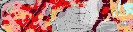
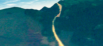
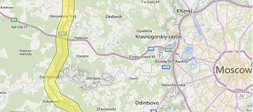
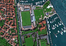
- Generation of reference plans based on up-to-date orthophoto maps;
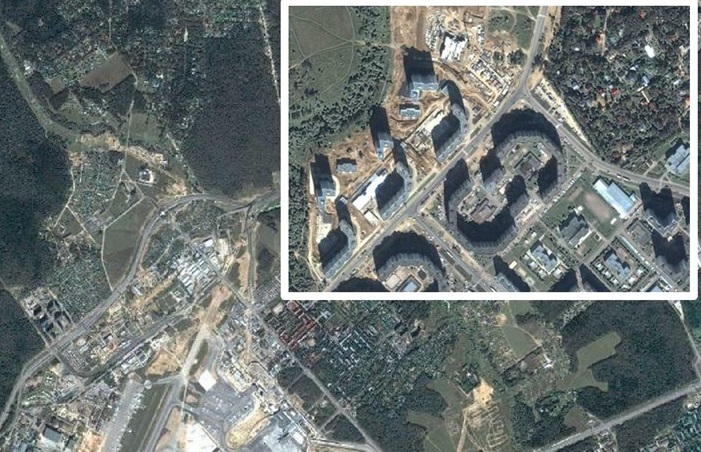
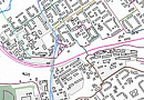
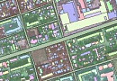
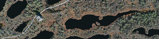
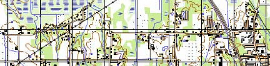
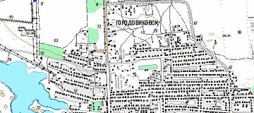
Figure: Creating reference plans based on up-to-date orthophoto maps
During the construction phase:
- Monitoring the implementation of the project throughout the entire life cycle of the construction site, following the construction schedule specified in the project documentation;
- Identifying deviations of the actual state from the project documentation;
- Monitoring the legitimate use of subsoil during construction;
- Assessing the impact of construction on the adjacent areas and compliance with environmental regulations;
- Monitoring compliance with construction deadlines.
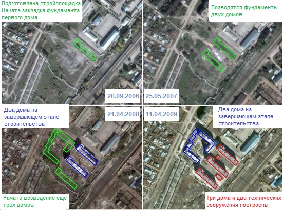
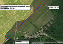
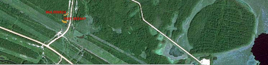
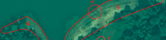
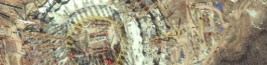
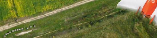
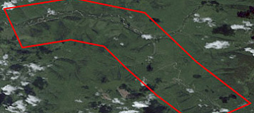
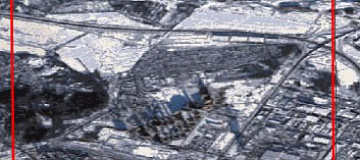
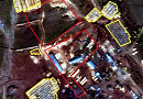
Figure: Identifying deviations of the actual construction state from the project documentation
During the operation phase:
- Environmental monitoring and monitoring of compliance with land legislation;
- Qualitative and quantitative assessment of ongoing negative processes and phenomena, as well as identifying trends in their development;
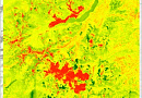
- Using radar interferometry data to identify areas with geodynamic changes.

You can order from us


Structures and Construction Monitoring (Structures Monitoring & Construction Monitoring) is a system for observing the process of building construction using aerospace imaging technologies, such as aerial imagery, unmanned aerial vehicles (UAVs), and laser scanning, at defined intervals.
Structures and Construction Monitoring (Structures Monitoring & Construction Monitoring) with remote sensing data is a system for collecting up-to-date and reliable information on the construction progress, allowing for analysis and assessment of the overall situation on the construction site.
Aerospace construction monitoring is carried out for:
- Making timely and informed engineering and managerial decisions;
- Obtaining information on the site's condition as close to real-time as possible, enabling analysis of the construction progress without physically being on-site;
- Creating an archive of imagery captured during the construction process, which can be used to resolve disputes;
- Verifying databases generated from documents (e.g., actual volumes of earthworks, actual dates of work completion, adherence to construction specifications, etc.);
During aerospace construction monitoring, the following tasks are addressed:
During the design phase:
- Qualitative and quantitative assessment of the initial state and dynamics of objects and territories for potential construction;
- Functional zoning of the potential construction site and adjacent areas;
- Preparation of topographic plans and specialized maps;
- Creation of 3D terrain models;
- Generation of reference plans based on up-to-date orthophoto maps;
Figure: Creating reference plans based on up-to-date orthophoto maps
During the construction phase:
- Monitoring the implementation of the project throughout the entire life cycle of the construction site, following the construction schedule specified in the project documentation;
- Identifying deviations of the actual state from the project documentation;
- Monitoring the legitimate use of subsoil during construction;
- Assessing the impact of construction on the adjacent areas and compliance with environmental regulations;
- Monitoring compliance with construction deadlines.
Figure: Identifying deviations of the actual construction state from the project documentation
During the operation phase:
- Environmental monitoring and monitoring of compliance with land legislation;
- Qualitative and quantitative assessment of ongoing negative processes and phenomena, as well as identifying trends in their development;
- Using radar interferometry data to identify areas with geodynamic changes.
Prices for services
| Consultation | Free |
|---|---|
| Ordering of Satellite Images | Starting from 300 USD per image depending on the spatial resolution and requirements of the satellite operators for the requested imagery |
| Image Processing, Vectorization, Technical Report Creation | Calculated individually based on the area of the site and the requirements of the technical task |
The price for construction monitoring services is calculated individually and depends on various factors, including the area and configuration of the site, the complexity of the construction project, the cost of suitable satellite imagery, the accuracy of the georeferencing, the frequency of monitoring, and other specific requirements.
The cost of execution is calculated on an individual basis, taking into account a specific of task.
After receiving the task description, we calculate the cost and send you a commercial offer.
Period of execution
Harmonization of terms of reference: from 1 to 5 days*Contract conclusion and advance payment receipt: from 1 to 5 days **
Contract execution: from 8 days **
TOTAL TIME: from 10 days*
** working days
** from the date of receipt of 100% advance payment
The timeframe for construction monitoring works depends on the total scope of works within the project and terms of reference and is calculated individually for each project.
How to place an order:
Need for consultation?
Fill the form and we will contact you
Stages of service provision
The result of the provision of services
The final product includes ready-to-load raster background (satellite images obtained with the required frequency), as well as vector layers and a comprehensive analytical report (if necessary).
Requirements for Source Data for Structures Monitoring & Construction Monitoring
- Precise location of the area of interest (coordinates, district name, region, SHP-file, etc.)
- Requirements for the frequency of monitoring
- Requirements for the accuracy of the final product
- Any other relevant information
If it is not possible to provide the specified information, provide details about the purpose of using the remote sensing materials. The specialists from "GEO INNOTER" LTD will analyze the requirements and offer an optimal solution to the problem.
Related services


Completed projects

Customers


FAQ
- Clearing the forest;
- Construction of a mineralized strip;
- Technical reclamation;
- Excavation (trenches, pits);
- Deviations from the project decisions, including overestimation of work volumes;
- Filling and compacting of the platform, roads;
- Monitoring the condition of roads;
- Concrete works;
- Driving metal piles;
- Installation of blocks, precast concrete panels;
- Installation of metal building structures, floor slabs;
- Cleaning up construction waste;
- And others.
- Conducting engineering and geodetic surveys of new construction sites.
- Ensuring the safe operation of enterprises, buildings, and structures, as well as pipeline transportation and the operation of fields (oil and gas).
- Executing reconstruction, major repairs, and restoration of objects, including buildings, structures, and oil and gas transportation facilities.
Licenses


Warranty
It is optimal to indicate the profile RF and international documents regulating the subject area under consideration. We guarantee 100% quality of services. Cooperating with GEO Innoter specialists, you eliminate risks and losses! The presence of qualified personnel with extensive experience in working with specialized software makes it possible to ensure timely and high-quality performance of work!Our partners


")


")

Articles

Sat-Sun: Non-working days