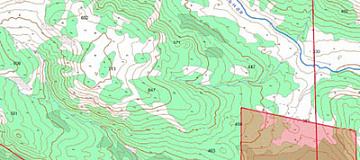
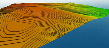
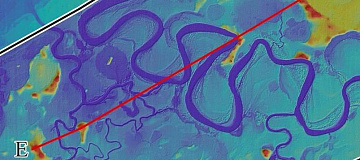
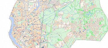
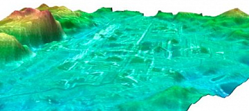
Digital terrain models (DTM) is a cartographic model that includes a logical-mathematical description of the terrain objects in digital form and contains data about their characteristics. DTM is created in the established map projections, scale, coordinate systems, and elevation systems, taking into account the principles of cartographic generalization and establishing necessary topological relationships between objects.

Digital Terrain Model (DTM) is a digital cartographic model that contains data about terrain objects and their characteristics.

The digital terrain model should be constructed in a way that independent models can be derived from it using established symbolic conventions for topographic maps, including:

  • terrain relief;
  • communication networks;
  • buildings and structures;
  • hydrography;
  • soil and vegetation cover.

What is needed for

A digital terrain model is necessary for mapping and arranging sites when designing landscaping, buildings, structures, highways, highways, interchanges. To solve the tasks of protecting the territory, conducting scientific research.


Differences between DEM/DMP and DMM

The DMM includes digital layers (models) (topography, vectors (objects with semantic characteristics), population distribution (administrative boundaries, boundaries of settlements with the number of inhabitants according to the last population census), obstacles (heights of buildings, vegetation and engineering structures)).

The DEM contains information about the height of only the true relief, excluding vegetation, buildings and other anthropogenic objects, the DMP contains information about all irregularities of the earth's surface, including vegetation and anthropogenic objects.

Работник

The purpose of creating a Digital Terrain Model (DTM) is to graphically represent spatial and coordinate information, and provide a description of the codes and symbols used in a specified area.

Digital terrain models are used to solve the following tasks:

  1. As an up-to-date digital map of any scale and purpose for solving cartographic tasks.
  2. In the creation and updating of digital topographic maps and plans.
  3. As part of the information support for geographic information systems (GIS).
  4. As a cartographic base for automated cadastral systems of various purposes.
  5. As a cartographic base for navigation and positioning systems.
  6. As part of the information support for planning mobile telephone network systems.
  7. For spatial referencing of thematic databases resulting from engineering surveys, land cadastral works, land surveying, statistical research, and other specialized works and surveys.

Advantages of Remote Sensing Data

Advantages of satellite imagery for creating DTM:

Satellite imagery of very high and high resolution can be obtained more quickly as they may already exist in operator archives, and new imaging does not require coordination with competent authorities.

Advantages of aerial imagery for creating DTM:

Aerial imagery allows for obtaining images with high spatial resolution (up to 1 cm/pixel) and provides a higher level of detail in the resulting orthophotoplans and models. It achieves a root mean square error (RMSE) of point coordinate determination of less than 10 cm, and can be performed below continuous cloud cover. Aerial imagery is recommended for creating high-precision DTM.

Advantages of unmanned aerial vehicle (UAV) imagery for creating DTM:

The use of UAV imagery for building digital terrain models (DTM) significantly expands the possibilities for studying space and obtaining information about it. It allows for obtaining a realistic and high-quality model in a compressed timeframe, comparable to laser scanning but more cost-effective.

Advantages of LIDAR for creating DTM:

  • High speed and accuracy of measurements.
  • The ability to use the acquired data to create maps, topographic plans, and drawings, including various cross-sections.
  • The ability to remotely survey inaccessible and dangerous objects (the range of the laser scanner depends on the instrument's characteristics and survey conditions, ranging from 1 to 2,500 meters).

Using a high-resolution camera, a coordinate array can be obtained simultaneously with real images, which is a significant advantage in DTM construction.

Prices for services

Creation of DTM:

Consultation Free of charge
Selection of images, preliminary analysis of the availability of source data, additional and reference materials Free of charge
Ordering of images From $0.5 to $200 per square kilometer depending on the type of imagery (archive or new, mono or stereo, resolution)*
Cost of DTM creation From $1 per square kilometer, calculated individually for each specific order, depending on the amount of remote sensing data to be processed, the availability (or absence) of ground control points, and the type of DTM used
Cost of creating (updating) digital terrain models (individually calculated for each client) Starting from 50,000 rubles. The cost of creation depends on the complexity category, execution time, and the area in square kilometers. The cost of updating depends on the degree of obsolescence of the previously created project, but not exceeding 50% of the creation cost.
TOTAL COST From 50,000 rubles

The price of creating a DTM depends on the cost of ordering images and the complexity of the work (including the number of images covering the area of interest, the availability of ground control points, and the complexity category of the work). The price is calculated individually for each customer.

Delivery of Finished DTM:

Consultation Free of charge
Selection of DTM, preliminary analysis of the availability of source data, additional and reference materials Free of charge
Ordering of DTM From $0.5 to $100 per square kilometer depending on the area of work
Cost of DTM update From $1 per square kilometer, calculated individually for each specific order, depending on the amount of data to be processed
Cost of updating digital terrain models (individually calculated for each client) The cost of updating depends on the degree of obsolescence of the previously created project
TOTAL COST From 50,000 rubles

Delivery Conditions for Finished DTM:

  • Delivery of finished DTM is made after 100% advance payment
  • Receiving DTM from the supplier (1 to 10 working days)
  • Verification of received data (1 to 5 days depending on the area of work)
  • Handover to the client

The cost of execution is calculated on an individual basis, taking into account a specific of task.

After receiving the task description, we calculate the cost and send you a commercial offer.

Period of execution

Creation of DTM

The deadline for completion of work is from 25 (twenty-five) working days from the date of receiving the advance payment, calculated individually for each customer.

The timeframe for completing the work depends on the total area, the amount of remote sensing materials to be processed, their type, and is calculated individually for each customer.

Delivery of Finished DTM

The timeframe for providing the service is from 10 (ten) working days from the date of receiving the advance payment, calculated individually for each customer.

How to place an order:

  1. Step 1: Submit an application on the website, providing the following information:
    • Mapping area (coordinates, name of the region, district, shapefile, etc.);
    • Requirements for the created/finished digital terrain model;
    • Requirements for remote sensing data, availability of source cartographic materials, additional and reference data;
    • Deadline for completion of work.
  2. Step 2: Agreement on the technical specifications and cost:
    • Purchase of remote sensing data, images are paid separately (from $8 to $200 USD per 1 km2 depending on the type of imagery: archival, new, mono-stereo, resolution);
    • Agreement on the work methodology and requirements for the produced deliverables.
  3. Step 3: Contract signing and commencement of work:

    The start date of the work for creating the DTM for decoding and vectorization is within 5 working days from the date of receiving 100% advance payment for the remote sensing materials. Payment is made only by bank transfer. The decoding and vectorization of objects start within 3 working days after the start of DTM creation.

Need for consultation?

Fill the form and we will contact you

By clicking the «Send» button, you give your consent to the processing of your personal data, in accordance with Federal Law No. 152-FZ of July 27, 2006 «On Personal Data», on the conditions and for the purposes specified in the Consent to the processing of personal data.

Stages of service provision

Stage 0 (Before Contract Signing):

  • Identify the tasks that require the use of a digital terrain model;
  • Familiarize yourself with the area of interest (size and characteristics of the terrain);
  • Agree on the accuracy requirements for the deliverables;
  • Preliminary selection and verification of archival images to meet the requirements for the deliverables;
  • Plan for new imagery if necessary;
  • Determine the availability of cartographic products from the client or public and private archives for updating or creating digital terrain models;

RESULT: Feasibility of providing the service (YES/NO)


Stage 1 (Before Contract Signing):

  • Agree with the client on the remote sensing data available in the operator's archives or order new imagery;
  • Determine the work methodology and agree with the client on the execution methods and timelines;
  • Agree with the client on the projection, coordinate systems, and height systems for the created or updated digital terrain models;
  • Agree with the client on the additional data that should be included in the created digital terrain models;
  • Agree with the client on the Technical Task for the entire scope of work;
  • Determine the labor costs, costs for remote sensing materials, additional and reference data, and agree on the delivery timelines and total cost of work.

RESULT: Signed contract

Stage 2 (Contract Execution):

  1. Receive advance payment (100% prepayment for the acquisition of remote sensing materials);
  2. Order remote sensing materials (conduct new imagery), order data from public and private archives, collect and analyze additional and reference materials;
  3. Prepare, agree on, and approve editorial and technical instructions for the creation or update of digital terrain models;
  4. Perform quality control of remote sensing materials;
  5. Create digital orthophotoplans necessary for the creation or update of digital terrain models;
  6. Decoding of orthophotoplans (thematic processing of remote sensing data) and vectorization of terrain objects to create digital terrain models;
  7. Perform visual and automated quality control of the produced deliverables;
  8. Export the created or updated project to the required formats, projection, and coordinate system;
  9. Prepare a technical report.

The result of the provision of services

As a result, the client receives a digital terrain model (DTM) of the specified type to solve their specific tasks.

The most common types of digital terrain models include the Digital Elevation Model (DEM), Clutter Model, Vector Model, Address Database, orthophotoplans, additional reference materials, and a technical report.

The digital terrain models are provided in formats compatible with software such as ASSET, ATOLL, Mapinfo, etc. (according to the client's requirements specified in the technical task).

All deliverables are provided on electronic media or via the Internet through FTP servers, and textual materials are also duplicated in printed form.


Requirements for Source Data

In order to perform the preliminary work effectively, the following information needs to be provided:

  • Coordinates of the mapping area (in any convenient format);
  • Type of digital terrain model to be created or updated, format of representation, desired scale, projection, coordinate system, and height system;
  • Availability of source cartographic materials, additional reference data;
  • List of coordinate points for photogrammetric processing of remote sensing data;
  • Requirements for the object composition and thematic information of the data project to be created or updated;
  • The need for the development and approval of Editorial and Technical Instructions for the creation or update of the data project.

Related services

Satellite imagery. Satellite data
Find out the price
Digital orthoimagery (Orthorectification)
Find out the price
Remote sensing imagery Interpretation & spectral analysis
Find out the price
Thematic mapping. Thematic map
Find out the price
Photogrammetric processing (Image Processing)
Find out the price
Фотограмметрические работы
Find out the price
Заказ космической съемки. Космоснимки
Find out the price
Создание ортофотопланов
Find out the price
Составление тематических и специальных карт, планов
Find out the price
Дешифрирование данных дистанционного зондирования Земли (ДЗЗ)
Find out the price

Customers

FAQ

  • Location of interest (location/coordinates of the object in any convenient format, and the area of the object);
  • Specific task that needs to be addressed using the DTM.
  • The main source of data for creating or updating the data project is the existing remote sensing data materials available in the archives of satellite operators, up to the most current date. Alternatively, new imaging can be commissioned.
  • Additional and reference materials such as geographical descriptions, maps, atlases of larger or smaller scales, directories, and any data available to the client are utilized in the creation or updating of the data project.
  • Existing cartographic products from public and private archives or cartographic products provided by the client can be used as the basis for updating the DTM.
Data shall be provided in the Customer's formats according to the requirements of the terms of reference
  • The timeframe for creating a digital terrain model based on satellite or aerial imagery data depends on the volume and complexity of the order. The minimum timeframe is 25 (twenty-five) working days.
  • The delivery timeframe for the completed digital terrain models is 25 (twenty-five) working days.
100% prepayment by invoice after signing the contrac

Completed digital terrain models, in the formats and according to the requirements of the manufacturer, can be obtained within 15 working days from the date of contract signing.

The creation of custom digital terrain models, based on the individual requirements of the client, involves ordering and obtaining archival imagery (10-15 working days) or ordering and obtaining new imagery (20-60 working days), gathering additional and reference information, creating and coordinating the methodology for the project, and so on.

The difference between the creation of DTM on space imagery, aerial imagery and laser scanning, is the accuracy according to the requirements of the terms of reference, the wishes of the customer, the term of execution (the use of archival data, the order of a new survey), the budget of the customer.
A Digital Terrain Model (DTM) represents the bare ground surface by removing features like buildings and vegetation, focusing solely on the Earth's terrain. It differs from a Digital Elevation Model (DEM), which includes both natural and man-made features.
Remote sensing data is used to create Digital Terrain Models by capturing elevation information from various sensors such as LiDAR (Light Detection and Ranging), radar systems, and optical sensors. LiDAR, in particular, is widely used for its high precision in measuring ground elevation.
Digital Terrain Models are valuable in applications such as urban planning, engineering, and environmental modeling. They contribute to infrastructure planning and design by providing accurate elevation data, aiding in the assessment of slope stability, drainage patterns, and overall terrain characteristics.
The resolution of remote sensing data directly affects the accuracy and detail of Digital Terrain Models. Higher resolution data, such as that obtained from high-density LiDAR scans, allows for more precise representation of terrain features and better capture of fine-scale elevation changes.
Digital Terrain Models can be integrated with GIS technology by overlaying them with other spatial datasets. This integration allows for spatial analysis, such as slope analysis, viewshed analysis, and cut-fill calculations, providing valuable information for decision-making in areas like land-use planning, environmental assessment, and infrastructure development.

In Geographic Information Systems (GIS), DTM stands for Digital Terrain Model. A DTM is a representation of the Earth's surface, excluding vegetation, buildings, and other man-made structures. It primarily focuses on the terrain itself, such as the ground surface elevations.

Here are key characteristics and uses of DTMs in GIS:

  1. Elevation Data: DTMs provide detailed information about the elevation of the land surface. This data is crucial for various applications like topographic mapping, land use planning, and environmental management.

  2. Surface Representation: Unlike Digital Surface Models (DSMs), which include the elevations of the terrain and all the objects on it, DTMs are used to model the bare earth surface.

  3. Applications:

    • Hydrology: Used in watershed and flood modeling to understand water flow and drainage patterns.
    • Engineering: Essential for infrastructure development projects, such as road construction, where understanding the terrain is critical.
    • Geology: Helps in analyzing geological features and landforms.
    • Agriculture: Used for precision farming by analyzing slope and aspect of fields to optimize planting strategies.
  4. Data Sources: DTMs can be generated from various sources, including:

    • LiDAR (Light Detection and Ranging): Provides high-resolution and accurate terrain data by using laser scanning technology.
    • Photogrammetry: Uses aerial or satellite imagery to create elevation models.
    • Surveying: Traditional ground surveying methods can also be used to collect terrain data.
  5. Data Formats: DTMs are commonly stored in raster format, where each cell contains an elevation value. They can also be represented as contour lines or triangulated irregular networks (TINs).

By providing a detailed and accurate representation of the Earth's bare surface, DTMs play a crucial role in a wide range of geospatial analyses and decision-making processes.

A Digital Terrain Model (DTM) is a digital representation of the bare-earth surface, excluding natural and man-made features like vegetation and buildings. It provides the elevation data of the ground surface, which is essential for various geospatial analyses and applications.

Key Points of a DTM:

  1. Elevation Data: DTMs offer detailed information about ground elevations, helping in understanding the topography of an area.

  2. Excludes Surface Features: Unlike Digital Surface Models (DSMs), which include all surface features, DTMs focus solely on the bare-earth surface.

  3. Uses:

    • Topographic Mapping: Essential for creating accurate maps that depict the terrain.
    • Hydrology: Used in watershed analysis, flood modeling, and understanding water flow.
    • Engineering and Construction: Critical for planning infrastructure projects like roads, bridges, and buildings.
    • Environmental Management: Helps in analyzing and managing natural resources and environmental impacts.
    • Agriculture: Assists in precision farming by understanding field topography for better crop management.
  4. Data Acquisition: DTMs can be created using:

    • LiDAR (Light Detection and Ranging): Provides high-resolution terrain data by using laser pulses to measure distances to the Earth's surface.
    • Photogrammetry: Uses overlapping aerial or satellite images to derive elevation data.
    • Ground Surveying: Traditional methods of collecting elevation data through physical surveying.
  5. Data Formats: DTMs are often represented in raster format, where each cell contains an elevation value. They can also be depicted using contour lines or as Triangulated Irregular Networks (TINs).

Definition:

A Digital Terrain Model (DTM) is a digital representation of the Earth's bare surface, providing elevation data by excluding natural and man-made features, used for a wide range of geospatial and engineering applications.

Licenses

Our partners