



The composition depends on the survey type (ALS, TLS, MLS) and the terms of reference: point cloud, elevation models, plans, 3D and aerial materials.
Search the site
What the service is used for
Surveys and design
A topographic base for design, survey and geological exploration works, drawings and as-built schemes.
Construction and infrastructure
3D models of bridges, interchanges, ports, stations, airports, quarries; operational control.
Oil and gas and mining
Complex industrial facilities, earthwork volumes, quarries, MSW landfills.
Roads and railways
Inventory and monitoring of linear objects; MLS up to 500 linear km per day.
Heritage and emergencies
Archaeology, restoration of monuments, documentation of emergencies.
Did not find your task?
Describe the object and the expected result. A specialist will select ALS, TLS or MLS and the set of deliverables.
What you will receive as a result of the survey
01
Laser survey materials (point cloud)
A set of points with X, Y, Z coordinates and reflected-signal intensity in the agreed format.
Modern scanners produce tens of thousands of points per second. The cloud can be coloured by intensity or in real colours if a camera is available.
What you get
- unclassified and classified point cloud
- X, Y, Z coordinates
- delivery in a convenient format, including LAS
- description of objects and territories per the ToR
Point density, classification and format are fixed in the terms of reference.
02
Digital elevation and terrain models
High-accuracy DEM and DTM: raster GRID and vector TIN.
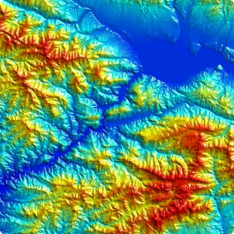
ALS is used to create DTM and DEM of linear and areal objects. Models are built from classified ground points.
What you get
- a digital elevation model
- a digital terrain model
- ground / non-ground classification
- data for profiles, slopes and volumes
Laser scanning accuracy is comparable to ground geodetic measurements and higher than aerial photography accuracy.
03
Topographic site plans and drawings
Created or updated topographic site plans at 1:500–1:5000 and as-built schemes.
TLS yields large-scale plans from 1:50 to 1:500 and facade plans. ALS — plans of linear and areal objects at 1:500–1:5000.
What you get
- topographic plans at the agreed scale
- drawings for construction companies
- as-built schemes
- an object monitoring report
Scale and drawing composition are defined by the terms of reference and the scanning type.
04
3D models, orthophotomaps and aerial images
Three-dimensional models of complex objects; orthophotomaps and perspective aerial images — for ALS per the ToR.
ALS is typically accompanied by aerial photography at 5–15 cm resolution in the visible and near-infrared ranges.
What you get
- 3D models of bridges, interchanges, ports, quarries, etc.
- orthophotomaps in the required ranges (ALS)
- perspective aerial images (ALS)
- delivery on media or via FTP
Orthoimagery and perspective images are prepared only for aerial survey and if provided in the ToR.
How the work goes
Cost and timeline
- order of works — from 300 000 RUB
- consultation — free
- preliminary analysis — free
- execution time in the table and contract stages — from 15 business days
- the cost is discussed individually and depends on specifics, goals, tasks, deadlines and result requirements
- the timeline depends on area, survey requirements, flight-permit approval for ALS, quality-control review and distance to the object
Order cost — from 300 000 ₽
Execution time — from 15 business days
Consultation and preliminary analysis — free
What is needed for a quote
To prepare a preliminary proposal, provide:
- a description of the task that requires laser scanning
- exact coordinates or territory boundaries, district/region name or an SHP file
- survey type: terrestrial, aerial or mobile
- requirements for point-cloud density, survey period and the final result
- whether a geodetic control network with reference markers is required
Don't know the technical parameters?
Describe the intended use of the results. Specialists will propose the optimal survey type and set of materials.
Why Innoter
Day and night survey
The technology does not depend on illumination intensity and produces almost no geometric distortions.
Accuracy down to 1 cm
A dense point cloud — hundreds and thousands of measurements per 1 m². Accuracy is comparable to ground geodesy and higher than aerial photography.
True terrain
Classification of ground points makes it possible to build a DEM without vegetation and buildings.
Territories without reference points
Tundra, snow, deserts and beaches where there are no ground contours for classical photogrammetry.
Three scanning types
Aerial, terrestrial and mobile — for area, facades, interiors or linear infrastructure.
Vegetation classification
Reflected intensity can be used to recognize vegetation type and condition.
Laser scanning types and technical constraints
Parameters are defined by the task, scale, required accuracy, platform type and the set of final materials.
1
Aerial (ALS) — from an airplane, helicopter, gyroplane or UAV, scales 1:500–1:5000, usually with aerial photography at 5–15 cm. Terrestrial (TLS) — objects from 0.5 cm with accuracy down to 0.5 mm, plans 1:50–1:500, productivity up to 4000 m² of facades at 1:50 and up to 20 ha of plans at 1:500, including in tunnels and interiors. Mobile (MLS) — from a moving platform, accuracy 5–8 cm, detail 1–5 cm, up to 500 linear km per day, swath 50–250 m.
2
TLS — high-accuracy scanning of small objects. ALS — areas from 1000 ha or densely built-up territories. MLS — roads, railways and linear infrastructure.
3
Survey does not depend on illumination and is possible day and night; high resolution and almost no geometric distortions; a point cloud — hundreds and thousands of measurements per 1 m², accuracy down to 1 cm; true terrain; work on tundra, snow and deserts without ground reference points; a vegetation classifier.
4
Advantages: three-dimensionality, 0.5 cm accuracy in the MLS advantages description, high productivity, no survey permit required, installation on a car, railcar or boat. Disadvantage: shadow zones (ditches, curbs, buildings); mitigated by field inspection or integration of ALS/TLS/MLS. Roofs are inaccessible; objects near the platform may obstruct the survey.
5
Exact coordinates of the area, point-cloud density, survey type (TLS, ALS, MLS), survey period and requirements for the final result. If parameters are missing — the intended use is enough, specialists will propose an option.








Frequently asked questions
Answers to key questions about service parameters, timelines, deliverable formats and workflow. If you did not find what you need — contact us and we will help.
- The task that needs to be solved using LiDAR survey;
- Area of interest (location / coordinates of the object in any convenient format, and the area of the object);
- Date or time interval for which the survey can be conducted;
- Requirements for the survey (type of survey, point cloud density, requirements for the final product, and delivery timeline).
The time of work execution depends on the area of the territory, remoteness from the Contractor's location, requirements to the type and parameters of the survey and the final product. VLS requires coordination of flight permits with the competent authorities, as well as time for control review by a representative of the headquarters of the military district where the VLS was conducted. The minimum lead time is from 20 working days.
Prepayment by bank transfer after signing the contract, the rest of the payment after the work is done. The price of scanning with a 3D scanner depends on the amount of work, the required detail and complexity of the configuration of the object. It is calculated not by theoretical formulas, but taking into account the real costs.
YES. We work with individuals and legal entities, Individual Entrepreneurs, state and municipal authorities, foreign customers and others.
Initially, lidar object data was obtained exclusively in ASCII format. With the accumulation of large amounts of lidar survey data, a binary format called LAS was put to work and became the standard format for organizing and distributing laser data. It is now quite common to see lidar data in LAS format. LAS is the most appropriate format because files in this format contain more information and, being binary (binary), they can be read more efficiently on import.
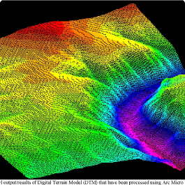
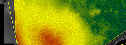
Such data is called Terrain - it is a surface based on TIN (Triangular Irregular Network) with variable resolution, constructed from measurements stored as spatial objects in a geodatabase. They are typically created using LiDAR and photogrammetric sources. Terrain datasets are part of a geodatabase and include objects used to create them.
Common classes of spatial objects that function as data sources for Terrain include:
- Multi-point classes of spatial objects: 3D point clouds created from data sources like LiDAR.
- 3D point and line classes of spatial objects: Created on photogrammetric workstations using stereo imagery.
- Study area boundaries: Used to define the extent of the Terrain dataset.
Terrain dataset rules control how objects are used to determine the surface.
The accuracy of the equipment is no more than 1-2 mm. This is very high compared to traditional measuring technologies.
Terrestrial laser scanning is the most modern method of field investigation. It is a new technology that avoids unnecessary waste in further design and construction. In complex cases, it is the only possible way to obtain accurate information about the configuration of an object, for example, in hard-to-reach places. With the help of laser scanning it is possible to create an actual digital model showing the state of the object in detail. By rotating the scanner horizontally by 180°, a full sphere is scanned except for the field below the device itself. After the data cloud is processed by the computer, distances to points and their coordinates become known, and a real-time visual model of the surrounding space is created. The number of points in the array can reach several tens of millions, so the real-time image of the object is as accurate and reliable as possible. To combine individual scans into a single field of points, special stamps are used. During processing, all scans are combined - stitched together - to produce a point cloud containing detailed information about the building parameters. This is the final product of field work. Later it can be used for various purposes - three-dimensional modeling of the object, determination of its geometry, clarification of deformations of parts or individual structures.
Before traditional methods such as theodolite surveying or measurements with a laser rangefinder, 3D scanning possesses the following advantages:
- Quick acquisition time;
- Obtaining a large amount of information about the object;
- High speed and accuracy of measurements;
- Completeness of the acquired information;
- Simplicity in the application of the equipment;
- Applicability of the survey results for various purposes;
- Possibility to conduct surveys both during the day and at night;
- Remote data acquisition, ensuring safety when surveying hard-to-reach areas;
- Data storage in electronic format, enabling its use for reconstruction, modernization, or monitoring of building, structural, and architectural deformations.
- Impossibility of surveying in the absence of visibility;
- Challenges in scanning glass structures or completely smooth surfaces;
- Lack of geodetic georeferencing. The scanner cannot independently determine its geographic coordinates, thus requiring the use of other geodetic instruments, such as a theodolite or GNSS receiver;
- Dependency on weather conditions.
During LIDAR aerial survey is carried out from several points of the scanner installation. Necessary settings are pre-set to perform measurements in automatic mode with a specified discreteness (laser beam pitch) Laser scanning is a modern method of taking accurate geodetic data to obtain 3D models of objects. It is necessary to use special equipment to carry out the work, which allows you to obtain highly accurate data on objects. Laser scanning companies can provide a wide range of surveying, surveying and design services for buildings and structures. They use state-of-the-art scanning technology to obtain accurate data, which allows them to create accurate 3D models of objects and speed up the work of creating projects. Laser scanning also allows you to survey existing buildings and structures, determine their condition and make repairs if necessary. With the help of the obtained data it is possible to create drawings of objects, taking into account their design features and parameters. Laser scanners will also help to determine the optimal conditions for the construction of new facilities, taking into account the geological and geodetic parameters of the territory. Thanks to the use of laser scanning, specialists can obtain accurate data about objects, which facilitates design and allows to speed up the work of creating projects. As a result, laser scanning is an indispensable tool in the design and construction of buildings and structures, and geodesy and specialized equipment help to carry out these works even more accurately and efficiently.
Three-dimensional modeling is used to create digital models of objects:
- that require reconstruction or major renovation, with complex spatial planning solutions, irregular axis intervals, and varying number of floors;
- that are cultural heritage;
- such as elevator shafts and collectors;
- of industrial facilities with complex configurations;
- of structures in the oil and gas industry (tank calibration and more).
Lidar and remote sensing allow scanning of urban environments and monitoring landscape changes. The obtained data is processed and converted into a point cloud, which is used for creating 3D models. The accuracy of measurements and data processing enable the application of laser scanning in various fields, such as topography, cartography, engineering surveys, and industrial safety.
Laser scanning has also found applications in architectural design, construction, and reconstruction. With precise geometry and the ability to create 3D models, more accurate drawings can be produced, reducing errors in the design process. Virtual reality and computer vision enable viewing objects from different angles and planning projects more effectively.
An essential component of laser scanning is GIS, which allows for analysis and management of the scanned data. Additionally, the use of aerospace technologies and accurate positioning improves the quality of the obtained data.
In general, laser scanning and point cloud processing are essential tools in the modern world, providing accurate data and its utilization in various fields, such as topography, cartography, engineering surveys, and industrial safety.
- Terrestrial Laser Scanning (TLS) is used for high-precision scanning of small objects.
- Aerial Laser Scanning (ALS) is optimally used for studying large areas with an area of 1000 hectares or densely built-up territories.
- Mobile Laser Scanning (MLS) performs well in scanning road networks, railways, and other linear infrastructure objects.
The mobile laser scanning system consists of the following components:
- A mobile platform designed to absorb shocks and vibrations.
- An odometer - a device for measuring the distance traveled by the vehicle.
- A control unit, user interface, and specialized software for managing the scanning process.
- A laser scanning unit (one or multiple units depending on the tasks).
- An integrated GPS/IMU navigation system - an inertial navigation system IMU combined with Global Positioning System (GPS) for precise positioning.
- High-resolution digital cameras.
- A base station or a network of GPS base stations and receivers for global navigation satellite systems.
Mobile laser scanning is one of the most high-tech modern survey methods in use today. Survey results yield a high-accuracy digital terrain model, which is the basis of geographic information systems used to solve a wide range of industry tasks.
The areas of application for laser scanning include:
• Transportation infrastructure
• Cities and settlements
• Energy facilities
• Large industrial enterprises
• Port and harbor infrastructure
• Quarries and open-pit mines
• Transportation infrastructure
• Cities and settlements
• Energy facilities
• Large industrial enterprises
• Port and harbor infrastructure
• Quarries and open-pit mines
LIDAR aerial survey is used for various purposes, including:
• Topographic surveying at scales of 1:500 and finer
• Data collection for thematic GIS
• Design, reconstruction, and construction of transportation system objects
• Technical condition analysis of support structures, contact lines, road pavement, and roadside infrastructure
• Determining critical vegetation proximity to contact lines and other road infrastructure objects
• Detection of unauthorized construction and activities within road reserve areas
• Inventory and documentation of road infrastructure objects
• Traffic optimization
• Monitoring and maintenance of road pavement and roadside infrastructure
• Determining track gauge and volume of road repair and restoration work
• Control of actual volumes and quality of road laying or restoration work
• Route selection for transporting oversized cargo
• Road expansion and roadside infrastructure planning
• Architecture and urban planning, territory planning and management
• Precise location determination of various terrain features and infrastructure objects
• Determining suitable locations for advertising structures
• Analysis of compliance with regulatory requirements for existing advertising structures
• Inventory and documentation of advertising structures
• Data collection and updating for restoration and reconstruction of objects
• Updating large-scale topographic plans of road urban networks, avenues, squares, and urban street development
• Vegetation survey (shrubs, trees, etc.)
• Surveying and determining geometric parameters of aerial communication lines (cables, pipelines, etc. over streets and roads) and multi-level structures (bridges, viaducts, etc.)
• Mutual coordination of engineering structures in design on densely developed territories
• Asset management and documentation of administrative and residential buildings
• Creation of high-resolution 3D models of cities
• Creating virtual images of planned objects, assessing their aesthetic value, and harmoniously integrating them into the existing urban landscape
• Solving problems of comprehensive urban development, transportation, engineering and social infrastructure, and urban improvement, assessing spatial integrity
• Highly accurate landscape and visual analysis of cities from the height of human growth
• Rapid measurement of buildings and structures. Creating models and survey drawings of building facades and structures
• Inventory and documentation of power transmission lines
• Determining sagging of wires, geometry of supports, and other geometric parameters
• Identifying critical vegetation proximity to power transmission lines
• Modeling and documentation of energy nodes and substations
• Determining volumes of work performed in open mines and quarries
• Safe and regular mine surveying measurements
• Determining warehouse volumes
• Topographic surveying at scales of 1:500 and finer
• Data collection for thematic GIS
• Design, reconstruction, and construction of transportation system objects
• Technical condition analysis of support structures, contact lines, road pavement, and roadside infrastructure
• Determining critical vegetation proximity to contact lines and other road infrastructure objects
• Detection of unauthorized construction and activities within road reserve areas
• Inventory and documentation of road infrastructure objects
• Traffic optimization
• Monitoring and maintenance of road pavement and roadside infrastructure
• Determining track gauge and volume of road repair and restoration work
• Control of actual volumes and quality of road laying or restoration work
• Route selection for transporting oversized cargo
• Road expansion and roadside infrastructure planning
• Architecture and urban planning, territory planning and management
• Precise location determination of various terrain features and infrastructure objects
• Determining suitable locations for advertising structures
• Analysis of compliance with regulatory requirements for existing advertising structures
• Inventory and documentation of advertising structures
• Data collection and updating for restoration and reconstruction of objects
• Updating large-scale topographic plans of road urban networks, avenues, squares, and urban street development
• Vegetation survey (shrubs, trees, etc.)
• Surveying and determining geometric parameters of aerial communication lines (cables, pipelines, etc. over streets and roads) and multi-level structures (bridges, viaducts, etc.)
• Mutual coordination of engineering structures in design on densely developed territories
• Asset management and documentation of administrative and residential buildings
• Creation of high-resolution 3D models of cities
• Creating virtual images of planned objects, assessing their aesthetic value, and harmoniously integrating them into the existing urban landscape
• Solving problems of comprehensive urban development, transportation, engineering and social infrastructure, and urban improvement, assessing spatial integrity
• Highly accurate landscape and visual analysis of cities from the height of human growth
• Rapid measurement of buildings and structures. Creating models and survey drawings of building facades and structures
• Inventory and documentation of power transmission lines
• Determining sagging of wires, geometry of supports, and other geometric parameters
• Identifying critical vegetation proximity to power transmission lines
• Modeling and documentation of energy nodes and substations
• Determining volumes of work performed in open mines and quarries
• Safe and regular mine surveying measurements
• Determining warehouse volumes
I Stage: Preparation for Scanning
• Route selection for scanning
• Selection of base station installation locations
• Installation of the system on the vehicle
II Stage: Data Collection
• System configuration verification and control
• Data collection and storage
• Management of high-capacity storage devices
• Analysis and visualization of measurement data with coordinate system alignment
• Quality control of acquired data
• Preservation of scanning history, scanning parameters, and operator actions
Results of the Scanning:
• Raw laser scanning data
• Raw video camera data
• Raw position and orientation data from the INS/GNSS system
• Raw data obtained from GPS base stations
Software included in the manufacturer's mobile scanning system control unit is used at this stage for data collection.
III Stage: Initial Data Processing
Initial data processing is performed using software included in the manufacturer's mobile scanning system control unit and INS/GNSS data post-processing software.
• Obtaining trajectory and position data in the WGS84 coordinate system
• Combination of laser scanning data and trajectory, coordinate transformation
• Visualization, calibration, and correction of scanning data
• Visualization and correction of video images
• Statistical analysis of alignment, verification of compliance with specified accuracy parameters
IV Stage: Data Post-Processing
Data post-processing at this stage can be performed using various laser scanning point processing, classification, and CAD modeling software, such as AutoDesk, Bentley Microstation, Terrasolid, Intergraph, etc.
Data post-processing may include:
• Classification of laser scanning points into corresponding layers ("ground - non-ground," "hydrography," "roads," "railways," "vegetation," "structures," "cables," "supports," "contact lines," etc.);
• Creation of 3D vector models of surveyed objects
• Creation of digital terrain models
• Creation of seamless orthomosaics for the entire survey area
• Creation of digital terrain models
• 3D modeling of objects:
o Creation of virtual models of terrain and objects
o Creation of videos, panoramas, animations
o Creation of photo plans
• Creation of thematic processing results tables:
o Assessment of geometric quality of road construction
o Road profiling
o Calculation of transverse and longitudinal slopes of roads
o Calculation of oversized dimensions
o Calculation of visibility zones
o Determination of volume of earthworks
o Determination of volume of construction materials used (sand, gravel)
o Determination of volume and area of road pavement
o Quality control of road pavement (undulation, inclination, rutting)
• Route selection for scanning
• Selection of base station installation locations
• Installation of the system on the vehicle
II Stage: Data Collection
• System configuration verification and control
• Data collection and storage
• Management of high-capacity storage devices
• Analysis and visualization of measurement data with coordinate system alignment
• Quality control of acquired data
• Preservation of scanning history, scanning parameters, and operator actions
Results of the Scanning:
• Raw laser scanning data
• Raw video camera data
• Raw position and orientation data from the INS/GNSS system
• Raw data obtained from GPS base stations
Software included in the manufacturer's mobile scanning system control unit is used at this stage for data collection.
III Stage: Initial Data Processing
Initial data processing is performed using software included in the manufacturer's mobile scanning system control unit and INS/GNSS data post-processing software.
• Obtaining trajectory and position data in the WGS84 coordinate system
• Combination of laser scanning data and trajectory, coordinate transformation
• Visualization, calibration, and correction of scanning data
• Visualization and correction of video images
• Statistical analysis of alignment, verification of compliance with specified accuracy parameters
IV Stage: Data Post-Processing
Data post-processing at this stage can be performed using various laser scanning point processing, classification, and CAD modeling software, such as AutoDesk, Bentley Microstation, Terrasolid, Intergraph, etc.
Data post-processing may include:
• Classification of laser scanning points into corresponding layers ("ground - non-ground," "hydrography," "roads," "railways," "vegetation," "structures," "cables," "supports," "contact lines," etc.);
• Creation of 3D vector models of surveyed objects
• Creation of digital terrain models
• Creation of seamless orthomosaics for the entire survey area
• Creation of digital terrain models
• 3D modeling of objects:
o Creation of virtual models of terrain and objects
o Creation of videos, panoramas, animations
o Creation of photo plans
• Creation of thematic processing results tables:
o Assessment of geometric quality of road construction
o Road profiling
o Calculation of transverse and longitudinal slopes of roads
o Calculation of oversized dimensions
o Calculation of visibility zones
o Determination of volume of earthworks
o Determination of volume of construction materials used (sand, gravel)
o Determination of volume and area of road pavement
o Quality control of road pavement (undulation, inclination, rutting)
Laser scanning of buildings (or laser scanning of surfaces, LIDAR - Light Detection and Ranging) is a technology that allows you to create a three-dimensional model of objects and surfaces with high accuracy and detail. The application of laser scanning of buildings can be useful in many industries such as architecture, construction, engineering, surveying and others. The working principle of laser scanning is to measure the distance between the instrument and the object using a laser beam. The laser beam is directed to the surface of the object, reflected from it and returned back to the instrument. From the delay time of the signal, the distance to the surface of the object can be determined. When scanning buildings with a laser, all visible surfaces of the building are scanned. The resulting data is used to create an accurate three-dimensional model of the building, which can be used for various purposes, such as design, repair, restoration or to create a virtual tour. One of the main advantages of laser scanning of buildings is the high accuracy and detail of the data obtained. This allows the creation of accurate three-dimensional models of buildings that can be used for a variety of purposes. In addition, laser scanning of buildings can be carried out relatively quickly, which saves time and resources when designing or renovating buildings.
-
Creating 3D models of objects and buildings - laser scanning allows for the creation of accurate 3D models of buildings, which can be useful for design, renovation, and construction purposes.
-
Quality control of construction works - laser scanning can be used to verify whether the completed construction meets the design parameters and requirements. This can help detect errors in construction and address them in a timely manner.
-
Determining the volume of work and cost estimation - precise data obtained through laser scanning can be used to calculate the volume of work and estimate construction costs.
-
Monitoring the condition of buildings - laser scanning can be employed to monitor the condition of buildings and detect damages or deformations in their structure.
-
Creating virtual tours - accurate 3D models of buildings, created through laser scanning, can be used to create virtual tours of the buildings, which can be beneficial for tourism or educational purposes.
In summary, laser scanning is an important tool in construction that can help expedite the construction process, improve the quality of work, and reduce costs.
A scanner is a device that is used to obtain accurate data about the surface of an object. A scanner can be used in various fields such as medicine, engineering, architecture, and manufacturing. A scanner can obtain precise measurements of an object, including size, shape, and structure. Scanners come in different types including laser, optical, ultrasonic and others. Laser scanners are one of the most common types of scanners that use a laser beam to measure distances and create point clouds. Scanners can be used to generate accurate data that can be used to create 3D models of objects and buildings, quality control of construction work, scoping and costing, monitoring the condition of buildings, and creating virtual tours. One of the most common applications of scanners is laser scanning, which provides accurate data about the surface of an object using a laser beam

Need satellite imagery or help choosing the right data?
Describe your task, area of interest, and desired outcome. We will check data
availability, assess new acquisition options, and propose the optimal solution in terms of timelines, cost,
and quality.
Discuss the project
clients who trust us
25+ years in the geodata market







