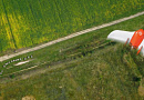
Forest Inventory - accounting of the forest, its material assessment: determining the age, height, and diameter of growing trees, timber stock, annual growth, forest plantations; qualitative assessment of the forest.
Forestry Survey - a complex of technical actions aimed at identifying, accounting for, and evaluating quantitative (stock) and qualitative (merchantability) characteristics of forest resources.
Why Forest Inventory is Needed
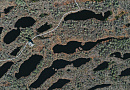
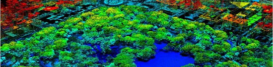
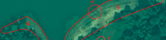
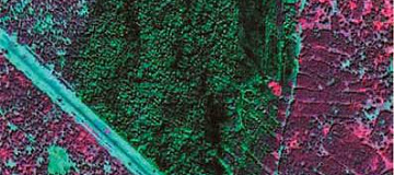
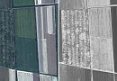
Forest inventory using deciphering methods is conducted to identify, account for, and assess quantitative and qualitative characteristics of forest resources (calculating the height and age of forest plantations, average diameter, average height, relative density, stand rating, stock per 1 ha).
Inventory is carried out before logging forest plantations for logging and sanitary purposes, as well as complete clear-cuttings for infrastructure projects, with the following result: re-measurement of the quantity and quality of the forest in a particular area, namely:
- determining the dimensions (height, diameter), age, species, number of growing trees, timber stock, and its annual growth for subsequent logging purposes.
Differences in Conducting Forest Inventory in Russia and in the European Union / Canada / USA:
The key task is to determine the volume of merchantable timber per hectare and per delineated canopy captured in the imagery, with known age and species composition. Other characteristics of the forest, as well as accounting for forestry activities and numerical estimation methods (sampling "strip" and others), are not considered. This is why it is easier to apply new DZZ technologies.
Moreover, in the USA / Canada / European Union, auditors accept data obtained by DZZ methods as the evaluation of merchantable timber stocks (forest resource assessment) with confirmation from reference areas.
Composition of Works for Assessing the Volume of Merchantable Timber:
-
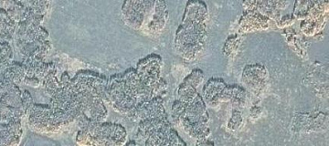
counting the canopies per hectare and delineated areas.
-
determining the type of canopy closure.
-
determining (clarifying) the species composition.
-
calculating the timber volume using an approximate formula of canopy ratio for a given age and stem diameter for a given forest type.

You can order from us


Prices for services
| Consultation | Free of charge |
|---|---|
| Aerial Imagery Collection, Preliminary Analysis | Free of charge |
| Photo Order | From $300 to $600 USD per photo (number of photos depends on the area of the territory) |
| Work of Technical Specialists | From 70,000 rubles (calculated individually) |
| Total | From 120,000 rubles (calculated individually)* |
*The price for forest inventory by decoding method depends on the cost of ordered aerial photos and the complexity of the process (number of photos, their total volume, the number and complexity of questions posed, the number of calculated parameters) and is calculated individually for each client.
The cost of execution is calculated on an individual basis, taking into account a specific of task.
After receiving the task description, we calculate the cost and send you a commercial offer.
Period of execution
Term of taxation execution - from 10 (ten) working days, calculated individually for each customer.How to place an order:
Need for consultation?
Fill the form and we will contact you
Stages of service provision
The result of the provision of services
Geo innoter provides the following:
- Report (forest inventory descriptions) including:
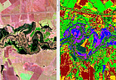
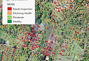
- Identification of forest tree species / creation of a species map of the forestry;
- Determination of forest canopy height;
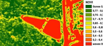
- Study of negative processes affecting forest areas: impact of pests and diseases, forest drying or overmoistening leading to degradation and mortality;
- Identification of forest areas, partially or completely knocked down by hurricane winds, determining windthrow areas, calculating biomass;
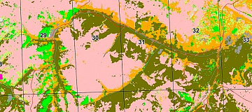
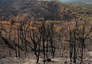
- Identification of existing cuttings and burn areas with documentary digitization of required accuracy;
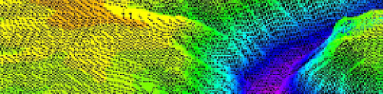
- Study of natural conditions that promote or hinder active forestry activities (identification of flat marshy areas, drained hollows, sharp changes in relief, etc.);
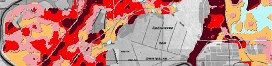
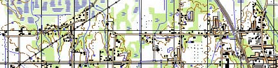
- Geoinformation database on forests (in an agreed format);
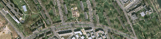
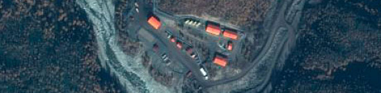
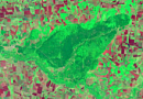
- Ready-made orthophotoplan or orthomosaic of the specified type and in the specified format (the transmitted data depends on the customer's request).
Requirements for Source Information
Accurate geographic coordinates of the object in the required coordinate system (specialists from Geoinnoter will refine the coordinates provided by the customer in any convenient form).
Images submitted for examination should meet the criteria of time of shooting, spatial resolution, and availability of required spectral channels and have initial georeferencing by RPC.
Orthotransformed images (georeferenced on-site) with the required accuracy.
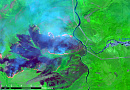
The mandatory condition for the application of the decoding method of forest inventory is the availability of remote sensing data with the following parameters:
- Types of remote sensing data: color spectral (multispectral) stereoscopic digital aerospace images (spectral channels R, G, B, NIR);
- Spatial resolution: not worse than 1 m (depends on the forest inventory class);
- Remote sensing data should be obtained in stereo mode;
- Solar elevation angle at the time of aerial and space imaging should be at least 25 degrees;
- Time since the date of image acquisition should not exceed 3 years.
The decoding method of forest inventory for the first and second forest inventory classes using images with a resolution up to 1 m per pixel (stereo is mandatory), and for the third forest inventory class for poorly managed forests using space images with a resolution up to 15 m per pixel (decoding method of forest inventory).
Related services


Completed projects


Customers


FAQ
- Location of the object of interest (coordinates, district name, region, shapefile, etc.);
- Requirements for the survey period (period for which archive data can be used or the need for a new survey);
- Forest classification level required for the forest inventory;
- Determination of quantitative and qualitative characteristics necessary for the research.
- Composition of existing stands and their origin;
- Form of green stands (single-layer or multi-layer);
- Average tree height;
- Stand structure in parks;
- Average size of all growing trees, their completeness, and quality;
- Forest type, forest management;
- Undergrowth and regeneration characteristics;
- Merchantable tree class;
- Current timber stock.
Licenses


Warranty
We guarantee 100% quality in fulfilling the contract. By collaborating with Geoinnoter specialists, you eliminate risks and losses!
We ensure that all work is conducted in accordance with the Order of the Ministry of Natural Resources and Environment of Russia dated 29.03.2018 N 122 (as amended on 12.05.2020) "On Approval of the Forest Management Instruction" (Registered with the Ministry of Justice of Russia on 20.04.2018 N 50859), and Article 23 of the Forest Code of the Russian Federation dated 04.12.2006 N 200-FZ.
Our team consists of experienced and qualified personnel who are proficient in using specialized software, providing a stable foundation for our guarantees!
Our partners


")


")

Articles

Sat-Sun: Non-working days