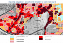
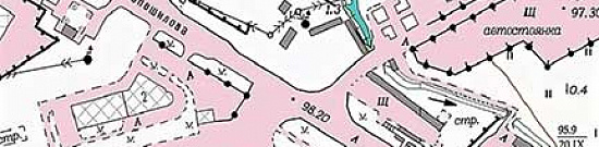
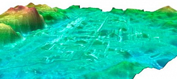
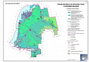
Seismic microzonation (Subsurface Imaging): A method of seismic zoning used to determine potential seismic impacts, including engineering terms, on specific existing and planned structures, territories of settlements, and individual regions. Scale of DSR maps: 1:500,000 - 1:200,000.
Seismic microzonation (Subsurface Imaging) (CMP, seismic microzoning, microseismorayoning, microseismicity): A method of seismic zoning that evaluates the influence of local (seismotectonic, geological, hydrogeological, geomorphological) features of the geological structure of areas. Scale of CMP maps for area objects: 1:25,000 and larger.
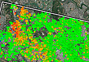
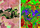
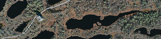
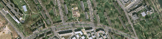
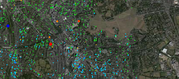
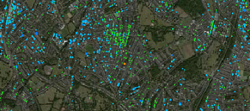
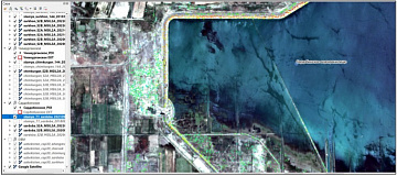
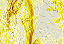
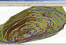
Seismic microzonation (Subsurface Imaging) — is the determination of seismicity of an exploration area based on materials refining the initial seismicity and detailed seismic zoning, taking into account local soil conditions from radar satellite imagery.
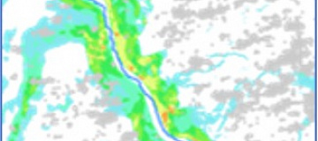
The study of seismic hazard based on remote sensing materials relies on identifying residual phenomena and deformations of the Earth's crust. Remote sensing materials allow the detection of zones of deep, regional, and local faults with associated seismic dislocations, which are the places of most probable occurrence of strong earthquakes.

You can order from us


Prices for services
| Activities | Free / Cost per Unit |
|---|---|
| Preliminary Analysis | Free |
| Purchase of Remote Sensing Data | The cost of remote sensing data is calculated individually for each order and may vary: the use of free satellite images and/or the use of commercial satellite images (minimum cost of $1000 per scene (minimum 5 scenes)). |
| Desktop Processing of Radar Remote Sensing Data | The cost of work starts from 500,000 rubles and depends on the volume and type of thematic data processing. |
*The cost of seismic microzonation work depends on the quality and type of final products, the volume of work, and is calculated individually for each customer.
The cost of execution is calculated on an individual basis, taking into account a specific of task.
After receiving the task description, we calculate the cost and send you a commercial offer.
Period of execution
Completion time - at least 30 (thirty) working days and is calculated individually for each customer.
Seismic microzonation completion time depends on:
- the area of the territory of interest;
- the availability of archived remote sensing data and the need for new data acquisition;
- requirements for remote sensing data, scale, and final product;
- requirements specified in the Technical Task.
How to place an order:
Need for consultation?
Fill the form and we will contact you
Stages of service provision
The result of the provision of services
LTD "GEO INNOTER" provides the Client with a technical report containing the results of interferometric processing of data, interpretation, and analysis of radar remote sensing materials with refined locations of tectonic fault zones and identified potential seismic dislocations on the study area. The report also includes identified ground displacement and deformations of the Earth's surface and structures that occurred during the observation period. Additionally, analysis of other necessary parameters required by the Client is conducted, and recommendations are provided regarding further detailed study with the involvement of necessary corresponding technologies. If necessary, conclusions are drawn regarding the establishment of the relationship between the detected changes and specific economic activities.
Requirements for Source Data
Precise coordinates of the area of interest, precise requirements for remote sensing data, and detailed requirements for thematic processing (types of processing required) of the output data formats.
If it is not possible to provide the specified information, information about the intended use of the service results is required, and specialists from "GEO INNOTER" will analyze the needs and propose an optimal solution to the problem.
Related services


Completed projects

Customers


FAQ
- the area of interest (location / coordinates of the object in any convenient form, and the area of the object);
- a specific task that needs to be solved using Earth remote sensing materials.
- The site should be determined on the basis of seismic micro-zoning (SMR), which can be performed by specialized engineering and survey institutions.
- In areas for which there is no SMR, it is allowed to determine seismicity based on the seismicity of the area and the results of engineering and geological surveys (IGI).
- If the seismicity of the site is determined by the results of the SMR, then no additional adjustment is required based on the results of the IGI.
- If the site is located on the border of existing SMR maps or on the border of different seismicity, then a special organization that compiles the SMR map should clarify the seismicity of the site.
- Clarification of the seismicity of the construction area should be carried out based on the materials of detailed seismic zoning (DSR) performed by the seismic services of the Russian Academy of Sciences (RAS).

Licenses


Warranty
&Our partners


")


")

Articles

Sat-Sun: Non-working days