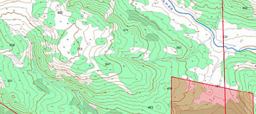
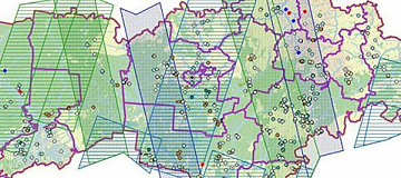
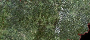
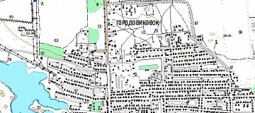
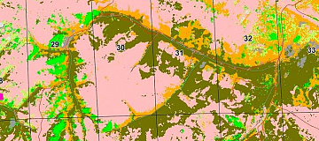
Thematic mapping — a geographical map whose content is defined by a specific theme. Thematic maps represent the distribution of various natural and socio-economic objects and phenomena, characterizing them qualitatively and quantitatively, showing the interrelationships between these objects and phenomena, and their development over time.
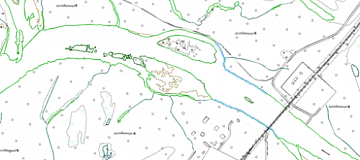
Special maps — are maps used for detailed examination of the terrain, aviation navigation support, transportation organization, and other specialized tasks (the list is regulated by the Resolution of the Government of the Russian Federation dated September 7, 2020, No. 1369).
Purposes of thematic maps
Geological maps - for understanding global, regional, and local characteristics of the Earth's crust structure, ongoing geological processes, exploration of mineral resources, and more.
Geophysical maps - for studying geodynamic phenomena and processes occurring in the Earth's shells and core, and for exploration of mineral deposits.
Relief maps - for examining the morphology, genesis, age, and dynamics of land and seafloor relief.

You can order from us
Prices for services
| Consultation | Free of charge |
|---|---|
| Search for images, preliminary analysis of the availability of source data, additional and reference materials | Free of charge |
| Image Ordering | From $0.5 to $70 per 1 km2, depending on the type of imagery (archive-new, mono-stereo, resolution)* |
| Cost of Creating Orthophotomaps | From $1 per 1 km2, calculated individually for each specific order, depending on the amount of remote sensing data processed, presence (absence) of ground control points, and the used digital elevation model (DEM). |
| Cost of Creating (Updating) 1 Topographic Map Sheet | The cost of creating 1 nomenclature sheet of the map starts from 40,000 rubles and depends on the map scale, complexity category, execution period, and number of nomenclature sheets. The cost of updating depends on the degree of map obsolescence but does not exceed 50% of the creation cost. |
| Execution Period | From 20 working days (depends on the volume, complexity category, availability of remote sensing data, additional and reference materials) |
The total cost of creating one nomenclature sheet of the map (from 40,000 rubles) includes the cost of remote sensing data materials used to create the orthophotomap, the cost of the work to produce it, the map's scale, complexity category, and creation period. The cost of updating depends on the degree of obsolescence of the updated map but does not exceed 50% of the creation cost.
The cost of execution is calculated on an individual basis, taking into account a specific of task.
After receiving the task description, we calculate the cost and send you a commercial offer.
Period of execution
Agreement of questions, analysis of the availability of remote sensing data (RS), source map materials, additional and reference data: from 1 to 5*
Contract signing: from 1 to 5*
Obtaining images: from 3 to 10**
Requesting and obtaining source map materials from the State Cartographic and Geodetic Control and Documentation (if necessary): from 1 to 20*
Creation of orthophotomaps (COFP): from 5*
Deciphering and vectorization: from 15*
Summarizing adjacent sheets, performing checks: from 5 to 10*
Report preparation: from 5 to 10
TOTAL TIME: from 20*
* working days
** from the date of receiving 100% advance payment for remote sensing data materials
The timelines for cartographic works depend on the number of nomenclature sheets, scale, and type of the created product, availability of archive remote sensing data, additional and reference materials.
It is essential to understand the purpose of creating the map, know the size, terrain characteristics, and required accuracy of the product to calculate the cost and timelines of the work.
How to place an order:
Need for consultation?
Fill the form and we will contact you
Stages of service provision
The result of the provision of services
Cartographic products, in formats, projection, coordinate system, and height, according to the Technical Task, consist of remote sensing data (RSD) in the form of digital orthophotoplans and source images, a set of additional and reference materials used in the work, editorial and technical instructions, and a technical report. All results will be delivered on electronic media or via the Internet through FTP servers, with text materials also duplicated in printed form.
Requirements for Source Data
For the qualitative execution of preliminary work, the following must be provided:
- Coordinates of the cartographic area (in any convenient form)
- Scale and type of the created (updated) map, format of presentation, how to provide data (per nomenclature sheets or within the cartographic area), projection, coordinate system, and height;
- Availability of source cartographic materials, additional, and reference data;
- Lists of coordinates of reference points for photogrammetric processing of remote sensing data;
- Requirements for the object composition, semantic information of the created (updated) map;
- The need for the development and coordination of Editorial and Technical Instructions for creating (updating) cartographic products.
If it is not possible to provide the specified information, it is necessary to provide information on the purpose of the maps and the types of work that are planned to be performed using the maps. The specialists of GEO INNOTER will analyze the information and prepare an optimal offer for creating (updating) cartographic products (maps).
In the process of creating up-to-date thematic maps, existing topographic maps and plans are systematized and used, the completeness and accuracy of which meet the requirements of the created scale, as well as engineering-geological maps, the results of surveys from previous years describing the development of exogenous processes in the survey area, and additional and reference materials (including materials from the CGCF, territorial inspections of the State Geonadzor, and reference-information systems of other agencies).
Photogrammetric processing of remote sensing data (DZZ) includes the creation of a plan-altitude basis, creation of a digital elevation model (DEM), obtaining synthesized images, and orthotransformation of images. The construction of a digital elevation model allows identifying a number of geological processes, such as solifluction and landslides, for example.
Deciphering of synthesized orthophotos, "attached" to the digital elevation model, allows not only detailing geological processes but also in some cases more accurately identifying the areas where a particular process occurs.
Related services


Completed projects
Customers
FAQ
- area of interest (location / coordinates of the object in any convenient form, and area of the object);
- the specific problem to be solved using the digital topographic map
- The terms of creating a digital topographic map based on space or aerial survey data depend on the volume and complexity of the order. The minimum term - from 5 (five) working days;
- Delivery time of finished digital topographic maps from 5 (five) working days.


