
You can order from us


Prices for services
| Consultation | Free |
|---|---|
| Selection of images, preliminary analysis, and preparation of technical specifications | Free |
| Ordering Remote Sensing Data (DZD) Images |
The cost of Remote Sensing Data materials is calculated individually for each order and may vary: - using free satellite images - and/or using commercial satellite or aerial images* |
| Work of technical specialists and expert(s) | From 500,000 RUB |
| TOTAL COST | From 500,000 RUB |
* - if the Client does not provide their materials or it is not possible to use free images.
The cost depends on:
- the complexity of the task;
- the area of the area of interest (working area);
- type of imaging - archive/new, free/paid images;
- number of images;
- quality characteristics of the images;
- complexity of the terrain;
- seasonality of work;
- size of the advance payment;
- whether it is necessary to purchase materials or they are provided by the Client;
- and other factors.
The cost of execution is calculated on an individual basis, taking into account a specific of task.
After receiving the task description, we calculate the cost and send you a commercial offer.
Period of execution
The duration of the work is from 20 working days from the date of receiving the advance payment and is calculated individually for each client.
The duration of the work depends on:
- the total area of the area of interest;
- availability of archival Remote Sensing Data materials, the need for new imaging;
- requirements for Remote Sensing Data materials and the final product.
The timeframe for providing the service depends on the complexity of the work and is calculated individually for each client.
How to place an order:
Need for consultation?
Fill the form and we will contact you
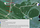
Stages of service provision
The result of the provision of services
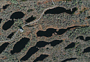
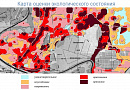
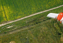
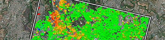
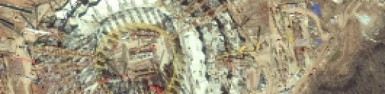
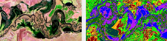
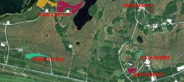
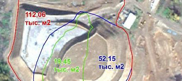
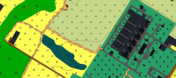
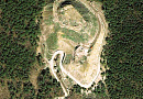
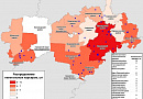
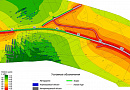
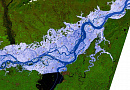
The Client receives a thematic map of the mining object's boundaries as of the date of the latest satellite imagery, which visually and numerically displays areas of pollution, with numerical indicators provided in the technical report. Additionally, more accurate data from UAVs and field surveys can be calculated and added to the map after coordination with the Client. Moreover, a Geographic Information System (GIS) can be created separately for this theme with vectorized layers for further development and monitoring, as per the Client's requirements.Requirements for Source Data
Accurate geographical coordinates of the object in the required coordinate system (specialists from "GEO INNOTER" will refine the coordinates provided by the Client in any convenient form).
Software:
- GIS - QGIS, ArcGIS, etc.
- Processing - ERDAS, ENVI SARscape, SNAP, etc.
Related services


Completed projects

Customers


FAQ
Licenses


Warranty
It is guaranteed to carry out works in accordance with SNIP, GOST and SP., in accordance with advanced methods and the use of the most modern software.We guarantee 100% quality of services. Cooperating with GEO Innoter specialists, you exclude risks and losses.
The availability of qualified personnel able to work with specialized software and many years of experience allows us to provide these guarantees!
Our partners


")


")

Sat-Sun: Non-working days